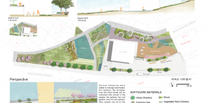
Cube Future
A landscape urbanism and design project aimed to regenerate the Granville Square in Sheffield, UK.
Body Trio
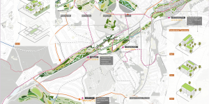
A landscape planning project attepted to revitalise the River Sheaf catchment in Sheffield, UK.
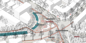
Urban Ecological Design
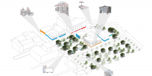
An ecological design project focused on stormwater management in Sheffield, UK.
Academic Posters
A collection of poster presentations produced during my undergraduate study at the University of British Columbia
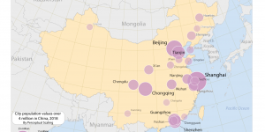
Case Study - Mexico City
A case study of Mexico City analysing the green and grey networks and fabrics as well as urban forms within a selected patch.
Determine Dominance and Location of Land Cover Types
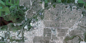
This project aims to identify the land cover types and their corresponding areas in the imagery by performing the unsupervised classification (Iso Cluster Classification) and the supervised classification (Maximum Likelihood Classification) in northern half of Edmonton, Canada.
Runway Park
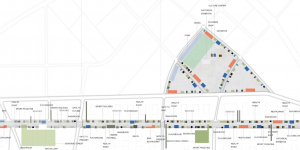
A self-led planning project aimed to renew the Nanjing Dajiaochang airport and showcase its past, present and future.
Theme Park Site
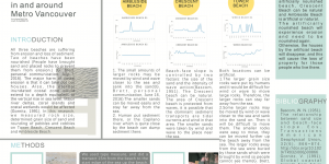
A GIS project identified potential sites for a large theme park in Metro Vancouver, Canada.
Architectural Drawing - House N
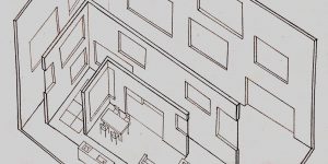
Technical architectural drawing work of House N project developed in 1st-year Environmental Design course
Landfill Regeneration
A self-led regeneration project transformed a former landfill into green spaces in Toronto, Canada.
Crime in the City
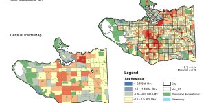
A GIS project using regression analysis to model the relation between residential break and enter crimes (B & E’s) and the total number of households and the median total household income.
River for Future
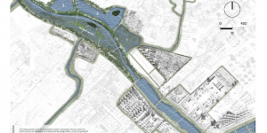
A self-led waterfront design project solved the pollution and disconnection issues of Daling River in China.
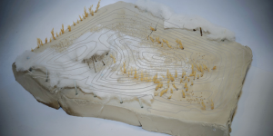
Digital Terrain Modelling and Multi-Criteria Analysis
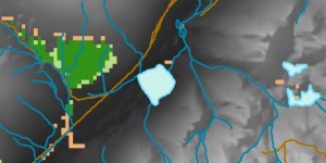
GIS project using MCE model to identify potential habitat for the rare species, Spiranthes diluvialis.
The Identification of a Least-cost Pathway
The primary purpose of this lab is to work with ArcGIS and to create least-cost pathways. Upon completion of this laboratory I should learn: 1. How to establish proper environmental settings when starting an ArcGIS project, and why that is a useful habit to adopt; 2. How to create a new layer, an address locator, and how to manipulate raster and vector data. 3. How to create a least-cost path.
Comparison of Crime Rate in Vancouver in 2011 and 2016
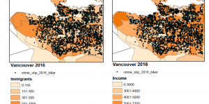
In this group project, we compared crime rate (Break & Enter) and its relationships with Income and immigration status in Vancouver between 2011 and 2016.
Environmental Risk Assessment: Garibaldi at Squamish Project
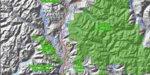
This is a scenario where the the BC Environmental Assessment Office requested a review recommendations from the Environmental Assessment of the Garibaldi at Squamish Ski Resort Proposal with regards to Whistler’s criticism in order to re-evaluate their own position on the project.
Quantitative Data Classification and Housing Affordability
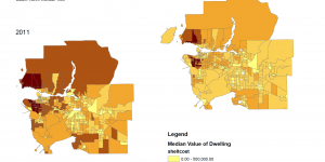
The classification of quantitative data in an extremely important process in GIS. This lab includes two maps which involve quantitative data classification and housing affordability in the Greater Vancouver Area.
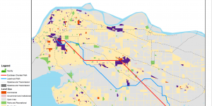
Vancouver Flood Risk Analysis: Identifying Tsunami Danger Areas
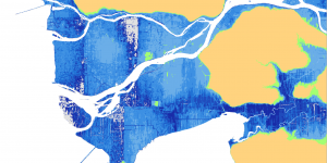
In this scenario, I was assigned as a GIS analyst with Metro Vancouver. I was assigned to create a series of maps that highlight the areas in the Metro Vancouver that are at risk of flooding or a storm surge.