
Body Trio
A landscape planning project attepted to revitalise the River Sheaf catchment in Sheffield, UK.
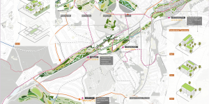
A landscape planning project attepted to revitalise the River Sheaf catchment in Sheffield, UK.
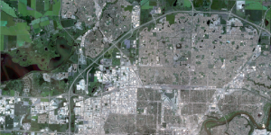
This project aims to identify the land cover types and their corresponding areas in the imagery by performing the unsupervised classification (Iso Cluster Classification) and the supervised classification (Maximum Likelihood Classification) in northern half of Edmonton, Canada.
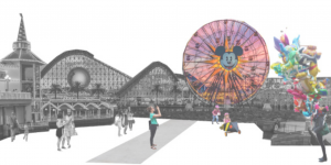
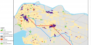
A GIS project identified potential sites for a large theme park in Metro Vancouver, Canada.
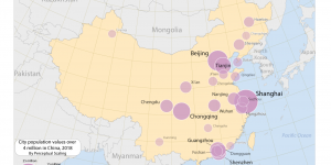
A collection of maps showcase my cartographical and data visualization skills.
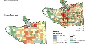
A GIS project using regression analysis to model the relation between residential break and enter crimes (B & E’s) and the total number of households and the median total household income.
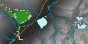
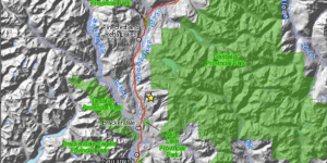
GIS project using MCE model to identify potential habitat for the rare species, Spiranthes diluvialis.
The primary purpose of this lab is to work with ArcGIS and to create least-cost pathways. Upon completion of this laboratory I should learn:
1. How to establish proper environmental settings when starting an ArcGIS project, and why that is a useful habit to adopt;
2. How to create a new layer, an address locator, and how to manipulate raster and vector data.
3. How to create a least-cost path.
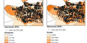
In this group project, we compared crime rate (Break & Enter) and its relationships with Income and immigration status in Vancouver between 2011 and 2016.
This is a scenario where the the BC Environmental Assessment Office requested a review recommendations from the Environmental Assessment of the Garibaldi at Squamish Ski Resort Proposal with regards to Whistler’s criticism in order to re-evaluate their own position on the project.
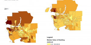
The classification of quantitative data in an extremely important process in GIS. This lab includes two maps which involve quantitative data classification and housing affordability in the Greater Vancouver Area.