Background
GIS analysts provide support to many environmental projects—both for the proponents and opponents of projects that have environmental impacts. Analysts can perform a variety of spatial analyses (e.g., environmental impact assessments, determining suitable least-cost routes, preparing 3-D simulations of projects); visualization of the results often is a significant component of this work. For example, the selection of the appropriate routes for pipelines and the potential impact of that pipeline (both in its construction as well as with respect to potential spills) have generated considerable controversy in recent years (e.g., Enbridge’s Northern Gateway Project). In this lab you will learn how GIS can be used by route planners, assisting them in identifying appropriate routes for pipelines, transmission corridors, etc.
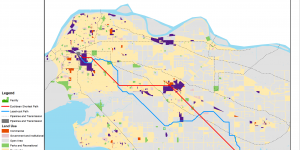
The problem being considered in this lab concerns the building of a new marijuana greenhouse facility (in anticipation of the law being changed this fall). This facility will use considerable amounts of electrical energy; this will require a feeder line to be built from an existing high voltage transformer station to the plant. Naturally, the new plant’s executives want the construction costs associated with building the new transmission line to be as inexpensive as possible. My task will be to determine the least-cost route for the new feeder line.


